Search Results
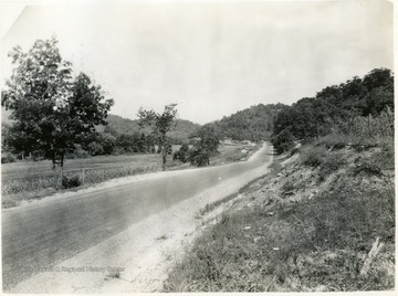
- IDNO:
- 014982
- Title:
- U. S. Route 52 Near Ferguson Station, Wayne County, W. Va.
- Date:
- 1932/08/26
- Description:
- 'Ferguson, W. Va. Camera located in highway, US Route 52, about 1000-ft from Ferguson Station, W. Va., looking north.'

- IDNO:
- 014983
- Title:
- Delivery Trucks at a Standard Gas Station in Genoa, Wayne County, W. Va.
- Date:
- 1932/11/02
- Description:
- 'The truck in front has Kentucky license.'

- IDNO:
- 014984
- Title:
- Truck Making Delivery to Store at Genoa, Wayne County, W. Va.
- Date:
- 1932/11/02
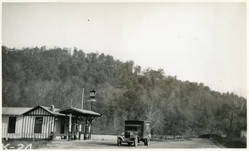
- IDNO:
- 014985
- Title:
- Truck Making Delivery to Store and Gasoline Station Two Miles West of Dunlow, Wayne County, W. Va.
- Date:
- 1932/11/02

- IDNO:
- 014990
- Title:
- Dirt Paved Road Between Lowney and Wilsondale, W. Va.
- Date:
- 1932/09/28
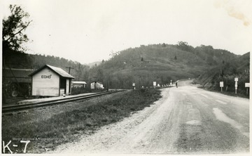
- IDNO:
- 014991
- Title:
- Highway at Echo, Wayne County, W. Va.
- Date:
- 1932/10/27
- Description:
- 'Echo, W. Va., looking east. This picture shows US Highway 52 and its junction with W. Va. State Route 37 with reference to the railroad.'
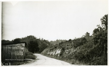
- IDNO:
- 014998
- Title:
- Road Near Mouth of Price Creek, Wayne County, W. Va.
- Date:
- 1932/09/21
- Description:
- 'Near the mouth of Price Creek, along County Road up Beech Fork, between Lavalette, W. Va., on Twelve Pole Creek, and Salt Rock on Guyandotte River.'
- IDNO:
- 014999
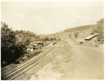
- Title:
- Town of Radnor, Wayne County, W. Va.
- Date:
- 1932/09/15
- IDNO:
- 015000
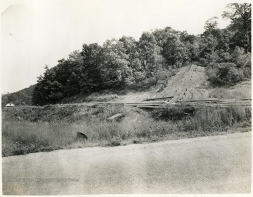
- Title:
- Abandoned Coal Operation, Wayne County, W. Va.
- Date:
- 1932/08/26
- Description:
- 'Adandoned coal operation, formerly the Ferguson Coal Company, Ferguson Siding, W. Va.'
- IDNO:
- 015001
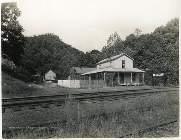
- Title:
- Doane, Wayne County, W. Va.
- Date:
- 1932/09/16
- Description:
- Large house next to the railroad tracks in Doane, W. Va.
- IDNO:
- 015002
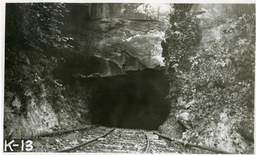
- Title:
- Mine Entrance in Wayne County, W. Va.
- Date:
- 1932/09/22
- Description:
- 'Showing the opening of a mine now in operation. This mine is served by trucks and wagons. Located on the opposite side of the mountain from the location formerly occupied by the 'Hope Splint Mine', and being about one-half mile due west from Ferguson Station. There is a certificate dated August 8, 1932, on a bulletin board inside of the opening. This certificate was issued by the State Mine Examiner of West Virginia to Spino and Wait Coal Company, Ferguson, W. Va., Mine #1, and is signed by W. D. Copley, Inspector, Matewan, W. Va.'

- IDNO:
- 015003
- Title:
- Loading Chute at Mine in Wayne County, W. Va.
- Date:
- 1932/09/22


