Search Results
- IDNO:
- 026197
- Title:
- New River Near Ivanhoe, Virginia
- Date:
- 1932
- Description:
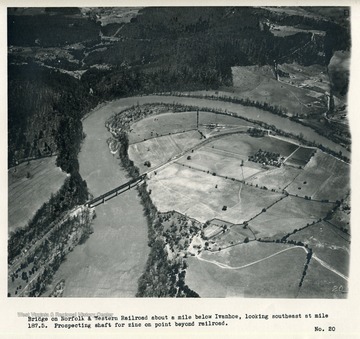
- 'Bridge on Norfolk & Western Railroad about a mile below Ivanhoe, looking southeast at mile 187.5. Prospecting shaft for zinc on point beyond railroad.'

- IDNO:
- 026198
- Title:
- New River Near Austinville, Virginia
- Date:
- 1932
- Description:
- 'Zinc mines at Austinville (mile 185.4); old tailings dump in center; old smelter just beyond; present main workings and mill buildings are just off picture to right. Operatives' cottages in left foreground. Office of Bertha Mineral Company, a subsidiary of New Jersey Zinc Company, post office and Austinville ferry to right of tailings. Iron Mountain in left background.'
- IDNO:
- 026199
- Title:
- New River Near Austinville, Virginia
- Date:
- 1932
- Description:
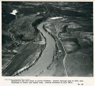
- 'Austinville and zinc mines in middle distance; present tailings dump to left; mill buildings in center just beyond town; looking southwest at mile 184.6.'

- IDNO:
- 026200
- Title:
- New River Near Austinville, Virginia
- Date:
- 1932
- Description:
- 'Bridge in foreground on U.S. Highway No. 121, which was constructed in 1930 and 1931 to replace Jacksons ferry; old ferry-boat still visible. About an inch above left end of bridge is old shot tower about 100 feet in height. Austinville in left distance. Looking west at mile 182.2.'
- IDNO:
- 026201
- Title:
- New River at Foster Falls, Virginia
- Date:
- 1932
- Description:
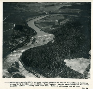
- 'Foster Falls at mile 180.7, the most decided concentrated drop on the portion of New River between North Carolina line and Hinton, West Virginia. Jackson ferry bridge and shot tower in middle distance. Looking south about noon. Patch of old growth pine to left.'
- IDNO:
- 026202
- Title:
- New River at Foster Falls, Virginia
- Date:
- 1932
- Description:
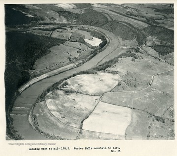
- 'Looking west at mile 178.2. Foster Falls mountain to left.'
- IDNO:
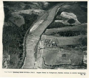
- 026203
- Title:
- New River in Virginia
- Date:
- 1932
- Description:
- 'Looking south at mile 176.7. Capper ferry in foreground; Bertha station in middle background.'

- IDNO:
- 026204
- Title:
- New River Near Barren Springs, Virginia
- Date:
- 1932
- Description:
- 'Looking northwest at mile 174.4 about 1 p.m. Barren Springs and ferry in middle; Reed Creek in upper left entering river just to left of picture; several wet-weather ponds in limestone sinks.'

- IDNO:
- 026205
- Title:
- New River Near Dry Pond Mountain, Virginia
- Date:
- 1932
- Description:
- 'Looking up Big Reed Island Creek. Dry Pond Mountain to left; Macks Mountain to right. Branch of Norfolk & Western extends up Little Reed Island Creek in right center of picture.'

- IDNO:
- 026206
- Title:
- New River Near Allisonia, Virginia
- Date:
- 1932
- Description:
- 'Looking west at Allisonia, mile 170.2 about 4 p.m., April 27, after landing to refuel and change film. Big Reed Island Creek entering under railroad bridge from left. Excavations to left of river are old iron workings. Recording gage installation of Geological Survey on bank of river near lower right-hand corner.'

- IDNO:
- 026207
- Title:
- New River Near Allisonia, Virginia
- Date:
- 1932
- Description:
- 'Looking southwest at mile 168.4 about a mile below Allisonia; ferry just below town; camera pointed toward sun.'

- IDNO:
- 026208
- Title:
- New River in Virginia
- Date:
- 1932
- Description:
- 'Looking west southwest; foreground at mile 161.3 about a mile below Macks Creek which enters from left in middle ground; Owens ferry at mouth of Creek. Pictures 30 to 37 show lands within backwater of project no. 739 of the Appalachian Electric Power Company; Nos. 28 to 40 are located on "General Map of Project" (F.P.C. No. 739-9).'


