Search Results
- IDNO:
- 030865
- Title:
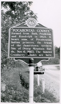
- Pocahontas County Historic Marker in West Virginia
- Date:
- 1952
- Description:
- "Formed from Bath. Pendleton, and Randolph in 1821. It bears name of Pocahontas, Indian princess, the friend of the Jamestown settlers. Site of Droop Mountain Battle, Nov. 6, 1863. The famous Cranberry Glades are here."

- IDNO:
- 030866
- Title:
- Edray Historic Marker on U. S. Route 219 in Pocahontas County, W. Va.
- Date:
- 1952
- Description:
- "Site of early settlement and fort of Thomas Drinnon. Scene of attacks by Indians in 1774 and 1778. To the east, on the land of Jacob Warwick, stood Fort Clover Lick, garrisoned during the Revolutionary War by Augusta County militia."

- IDNO:
- 030867
- Title:
- Greenbrier County Historic Marker in West Virginia
- Date:
- 1952
- Description:
- "Formed in 1778 from Botetourt and Mongomery. named for the river which drains it. This county had many pioneer forts and saw many bloody Indian battles. World-famed mineral springs at White Sulphur and elsewhere in Greenbrier Valley."
- IDNO:
- 030868
- Title:
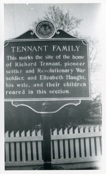
- Tennant Family Historic Marker in West Virginia
- Date:
- 1951
- Description:
- "This marks the site of the home of Richard Tennant, pioneer settler and Revolutionary War soldier, and Elizabeth Haught, his wife, and their children reared in this section."
- IDNO:
- 030869
- Title:
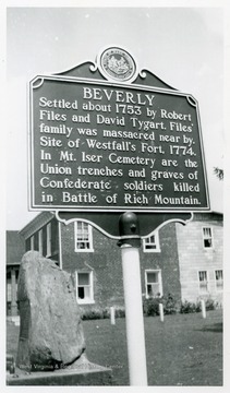
- Beverly Historic Marker, Randolph County, W. Va.
- Date:
- 1952
- Description:
- "Settled about 1753 by Robert Files and David Tygart. Files' family was massacred near by. Site of Westfall's Fort, 1774. In Mt. Iser Cemetery are the Union trenches and graves of Confederate soldiers killed in Battle of Rich Mountain."

- IDNO:
- 030870
- Title:
- Monongalia County Historic Marker on U. S. 119 between Morgantown and Grafton, W. Va.
- Date:
- 1951
- Description:
- "Formed, 1776, from District of West Augusta. All or parts of 21 other counties, including three in Pennsylvania, were carved from it. Named for the Monongahela River, bearing an Indian name, which means the "River of Caving Banks."

- IDNO:
- 030871
- Title:
- Early Oil Wells Historic Marker on U. S. Route 50 in Ritchie County, W. Va.
- Date:
- 1950
- Description:
- "Early Oil Wells--To the south, birthplace of West Virginia's oil industry. On Hughes River oil was found in gravel beds in 1810. As "bank oil," a medicine, Bushrod Creel sold 100 barrels of it per year in 1836. Volcano was one of first boom oil towns."
- IDNO:
- 030872
- Title:
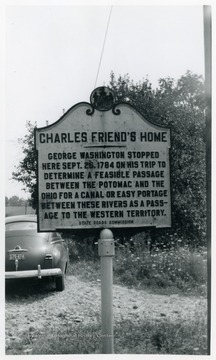
- Charles Friend's Home Historic Marker between Terra Alta, W. Va. and Oakland, Md.
- Date:
- 1955
- Description:
- "Charles Friend's Home--George Washington Stopped here Sept. 26, 1784 on his trip to determine a feasible passage between the Potomac and the Ohio for a canal or east portage between these rivers as a passage to the Western Territory."
- IDNO:
- 030873
- Title:
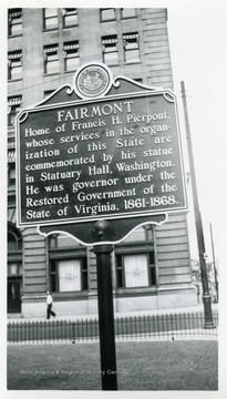
- Fairmont Historic Marker in Courthouse Square, Fairmont, W. Va.
- Date:
- 1951
- Description:
- "Fairmont--Home of Francis H. Pierpont, whose services in the organization of this State are commissioned by his statue in Statuary Hall, Washington. He was governor under the Restored Government of the State of Virginia, 1861-1868."
- IDNO:
- 030874
- Title:
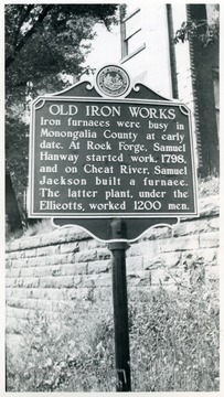
- Old Iron Works Historic Marker near the Walnut Street Bridge, Morgantown, W. Va.
- Date:
- 1951
- Description:
- "Old Iron Works--Iron furnaces were busy in Monongalia County at early date. At Rock Forge, Samuel Hanway started work, 1798, and on Cheat River, Samuel Jackson built a furnace. The latter plant, under the Ellicotts, worked 1200 men."
- IDNO:
- 030875
- Title:
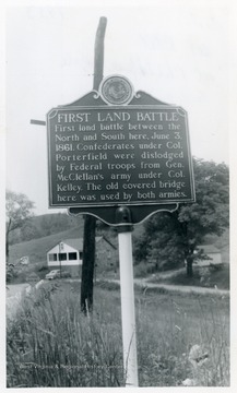
- First Land Battle Historic Marker on U. S. Route 250 at Philippi, W. Va.
- Date:
- 1953
- Description:
- "First Land Battle--First land battle between the North and South here, June 3, 1861. Confederates under Col. Porterfield were dislodged by Federal troops from Gen. McClellan's army under Col. Kelley. The old covered bridge here was used by both armies."

- IDNO:
- 030876
- Title:
- Tollgate Historic Marker on U. S. Route 50 in Ritchie County, W. Va.
- Date:
- 1950
- Description:
- "Tollgate--The Northwestern Turnpike, a favorite project of George Washington, opened in 1838. Such highways were called "turnpikes" from the gates at which tolls were collected. This town is named for the toll gate which stood here."


