Search Results

- IDNO:
- 028257
- Title:
- Horse and Buggy at Greenbrier Ford
- Date:
- 1884/07/17
- Description:
- A photograph of a river with a horse and carriage on the left. '54 D(30); Thur. July 17, 1884 8 am'

- IDNO:
- 028258
- Title:
- Summit of Allegheny Mountain
- Date:
- 1884/07/17
- Description:
- A picture of a field with a mountain in the backgound. '55 D(31); Thu. July 17, 1884 2-30 pm'
- IDNO:
- 028259
- Title:
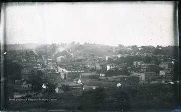
- Staunton, Va., Northern Half
- Date:
- 1884/07/21
- Description:
- '65 D (39); Mon. July 21, 1884, 5:25 pm'

- IDNO:
- 028260
- Title:
- Town of Harpers Ferry and Jefferson Rock Looking North from Bank of Shenandoah River
- Date:
- 1884/08/04
- Description:
- '142(83)D; August 4, 1884, 4 pm, Monday (sun)'
- IDNO:
- 028377
- Title:
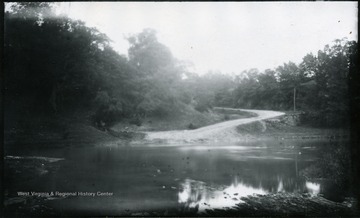
- Ford of Opequon Creek Where Sheridan's Army Crossed in 1864
- Date:
- 1884/07/31
- Description:
- '114.D.(68); July 31, 1884, Thursday 6-15 pm; sun in cloud; Sheridan army crossed here in '64 going to the battle of Winchester (West). Ford is shallow not more than knee deep. View was taken before we crossed. Current of river is from right to left.'
- IDNO:
- 028379
- Title:
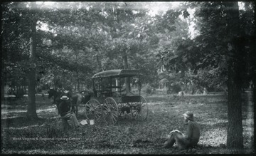
- Camp in Oak Grove East of Winchester, Va.
- Date:
- 1884/08/01
- Description:
- '(69)D.115; August 1, 1884, Friday 8-40 am; 2 1/2 miles E of the ford of Opequon. On the right hand side of the pike (South). There was no fence on that side the whole length of the grove. We camped in ground a distance from the road which is behind us in the view. Just finished breakfast. There is a home nearby on the Eastern edge of the grove from whence a young man came to watch us eat our meal. Camera box on the ground near the wagon.'

- IDNO:
- 028383
- Title:
- Halltown a Few Miles Southwest from Harpers Ferry, W. Va.
- Date:
- 1884/08/02
- Description:
- '122(73)D. I.C.; Aug. 2, 1884, Saturday 10 a.m. cloudy; Halltown a few miles S.W. from Harpers Ferry. Looking N.E. toward Harpers Ferry. The town of Loudon Heights can be just made out. Halltown is only a cluster of a few houses, a RR station, factory and a store. In the village we passed a pretty pond which would have made a good picture, but we hurried through on account of the proximity of the R.R. The building with the cupola is a school house.'

- IDNO:
- 028384
- Title:
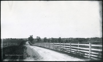
- Looking N.E. towards Harpers Ferry, W. Va.
- Date:
- 1884/08/01
- Description:
- '121 D.(72) I.C. 121; Aug. 1, 1884, Friday 6-20 p.m.; Half mile out of Charles Town. Looking N.E. towards Harpers Ferry. Maryland Heights are on the left of the gap and Loudoun Heights on the right. Through the gap on the N. side can be seen the South Mt. The nearer ridge under Maryland Heights is Bolivar Heights and the still nearer ridge extending across the whole picture is Halltown Heights and was the fortified line chosen by Sheridan when he took command in '64. On the extreme right lie the farms through which we wandered in lanes and field in search of hay, finally camping 1/2 mile or more away from the pike.'
- IDNO:
- 028385
- Title:
- Charles Town, Old Virginia, From Pike 3/4 of a Mile South of Town
- Date:
- 1884/08/01
- Description:
- '(71)D.119; August 1, 1884, Friday 5-20 pm. clear sun; Bonfire burning on right. Court house with clock tower in center.'
- IDNO:
- 028386
- Title:
- Berryville From the West
- Date:
- 1884/08/01
- Description:
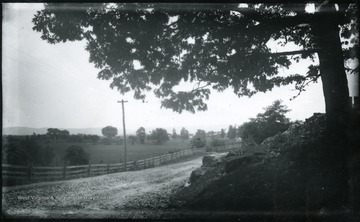
- '116.D.(70); August 1, 1884, Friday 10-25 am; bright sun; Camera stands at the entrance to the grounds of a fine old house on the right hand. Boy on horseback just behind the camera wanted to be taken, sorry I didn't. View is looking East at Berryville. The Pike turns at right angle toward the left to Harpers Ferry.'
- IDNO:
- 028387
- Title:
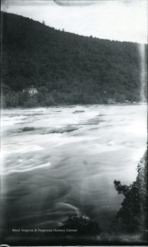
- Rapids of Shenandoah River at Harpers Ferry, W. Va.
- Date:
- 1884/08/04
- Description:
- '143; 84D; August 4, 1884, Monday 4:20 pm.'

- IDNO:
- 028388
- Title:
- Two Boys Who Made Friends With Walter Biscoe
- Date:
- 1884/08/02
- Description:
- A photograph of two young boys on the left with a river below. '137.W.(58); August 2, 1884, Saturday 6 pm.'


