Search Results

- IDNO:
- 026187
- Title:
- New River Near Galax, Virginia
- Date:
- 1932
- Description:
- 'Looking south southwest at mile 208.5. New steel bridge on State Highway no. 12 in left center. Dam site of Eastern States Development Company (Project No. 575) just below bridge. Recording gauge installation of Geological Survey at right end of bridge (New River near Galax, Virginia).'

- IDNO:
- 026188
- Title:
- New River in Virginia
- Date:
- 1932
- Description:
- 'Looking south southwest at mile 206.7. Dickinson ferry in middle background just below island.'

- IDNO:
- 026189
- Title:
- New River at Fries, Virginia
- Date:
- 1932
- Description:
- 'Looking southwest at mile 201.3 about one mile below dam at Fries. Blair ferry in middle ground. Branch of Norfolk & Western Railroad on west side of river.'
- IDNO:
- 026190
- Title:
- New River at Fries, Virginia
- Date:
- 1932
- Description:
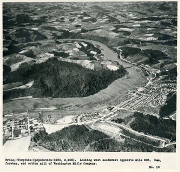
- 'Fries, Virginia (population 1930, 2,205). Looking west southwest opposite mile 203. Dam, forebay, and cotton mill of Washington Mills Company.'
- IDNO:
- 026191
- Title:
- New River Near Galax, Virginia
- Date:
- 1932
- Description:
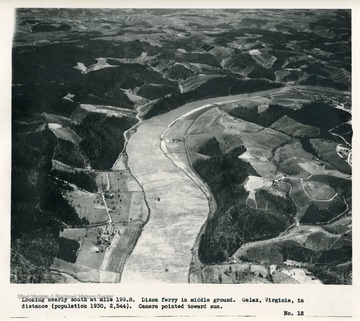
- 'Looking nearly south at mile 199.8. Dixon ferry in middle ground. Galax, Virginia, in distance (population 1930, 2,544). Camera pointed toward sun.'
- IDNO:
- 026192
- Title:
- New River Near Tobys Knob, Virginia
- Date:
- 1932
- Description:
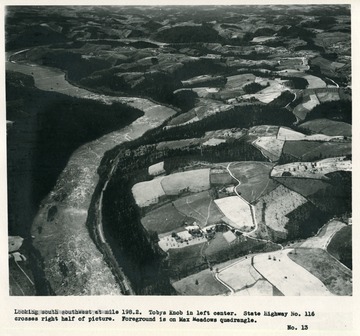
- 'Looking south southwest at mile 198.2. Tobys Knob in left center. State Highway No. 116 crosses right half of picture. Foreground is on Max Meadows quadrangle.'

- IDNO:
- 026193
- Title:
- New River Near Galax, Virginia
- Description:
- 'Looking west southwest at mile 196.6. Fries Junction on Norfolk & Western Railroad; bridge is on Galax branch which extends up Chestnut Creek.'

- IDNO:
- 026194
- Title:
- New River in Virginia
- Date:
- 1932
- Description:
- 'Looking south at mile 194.6. Byllesby hydroelectric plant of Appalachian Electric Power Company.

- IDNO:
- 026195
- Title:
- New River in Virginia
- Date:
- 1932
- Description:
- 'Looking east southeast at mile 192.5. Buck hydroelectric plant of Appalachian Electric Power Company; Poplar Camp Mountain on left; on right slopes of Round Top which are included in Unaka National Forest.'
- IDNO:
- 026196
- Title:
- New River Near Ivanhoe, Virginia
- Date:
- 1932
- Description:
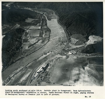
- 'Looking south southeast at mile 190.4. Carbide plant in foreground; Buck hydroelectric plant in background; substation in center; Unaka National Forest at right, gaging station of Geological Survey at Ivanhoe just to left of picture.'
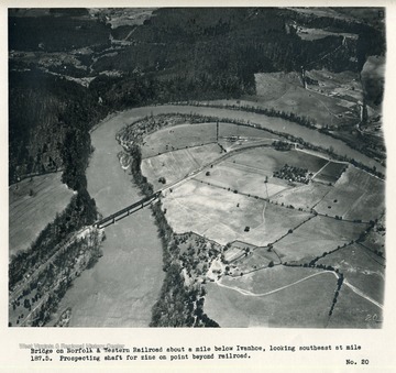
- IDNO:
- 026197
- Title:
- New River Near Ivanhoe, Virginia
- Date:
- 1932
- Description:
- 'Bridge on Norfolk & Western Railroad about a mile below Ivanhoe, looking southeast at mile 187.5. Prospecting shaft for zinc on point beyond railroad.'

- IDNO:
- 026198
- Title:
- New River Near Austinville, Virginia
- Date:
- 1932
- Description:
- 'Zinc mines at Austinville (mile 185.4); old tailings dump in center; old smelter just beyond; present main workings and mill buildings are just off picture to right. Operatives' cottages in left foreground. Office of Bertha Mineral Company, a subsidiary of New Jersey Zinc Company, post office and Austinville ferry to right of tailings. Iron Mountain in left background.'


