Search Constraints

You searched for: Date 1932 Remove constraint Date: 1932 Geographic Names Cotton Hill (W. Va.) Remove constraint Geographic Names: Cotton Hill (W. Va.) Projects West Virginia History OnView Remove constraint Projects: West Virginia History OnView
Number of results to display per page

Search Results

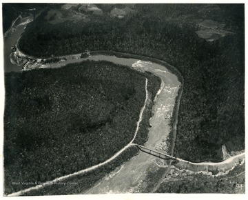
'Looking southeast at mile 5.4.  Bridge at Cotton Hill on U.W. Highway No.19, Highway extends down Laurel Creek from west (left) follows down New River canyon for about two miles, then turns east.'
'Looking east northeast at mile 3.2.  Adit to Hawks Nest tunnel near center of picture.  Route U.S. 60 on side of canyon.  Route No. 19 joins it near right, coming up from Cotton Hill bridge.'