Search Results

- IDNO:
- 005454
- Title:
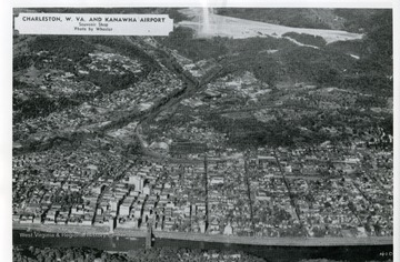
- Aerial View of Charleston, W. Va. and Kanawha Airport
- Date:
- 1952
- Description:
- A picture postcard of Charleston, West Virginia and Kanawha Airport.

- IDNO:
- 006518
- Title:
- Helen Holt Smiling at the Podium in front of a Portrait of Dwight D. Eisenhower
- Date:
- 1952
- Description:
- Letter dated August 22, 1952 accompanying the photograph reads, 'Memorandum from Walter S. Hallahan To: Honorable Rush D. Holt, Weston W. Va. Dear Rush - I thought you would be interested in receiving a photograph or two taken at the Testimonial Dinner last Monday evening. It was a wonderful event for me and I want you to know how much I appreciated having you with me on that occasion. Walter' Helen Holt

- IDNO:
- 008138
- Title:
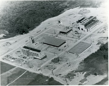
- Bureau of Mines Buildings Under Construction, Morgantown, W. Va.
- Date:
- 1952
- Description:
- Group of buildings that houses the Bureau of Mines.

- IDNO:
- 011109
- Title:
- Aerial View of Morgantown, W. Va.
- Date:
- 1952
- Description:
- An aerial view of the Morgantown business district.

- IDNO:
- 011211
- Title:
- Aerial View of Crump Housing Development on Collins Ferry Road, Morgantown, W. Va.
- Date:
- 1952

- IDNO:
- 012697
- Title:
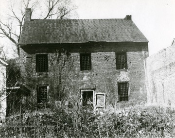
- Back of the Old Hardy County Jail, Hardy County, W. Va.
- Date:
- 1952

- IDNO:
- 012910
- Title:
- Bird's Eye View of Washington Street in Moorefield, Hardy County, W. Va.
- Date:
- 1952
- Description:
- View of Washington Street in Moorefield from the cemetery.

- IDNO:
- 013255
- Title:
- Appalachian Electric Power Company Plant, Glasgow, Kanawha County, W. Va.
- Date:
- 1952
- Description:
- 'The new 400,000 kilowatt Kanawha River Plant of Appalachian Electric Power Company at Glasgow, West Virginia, as it appears from the river side. The first of two 200,000 kilowatt units is now in service. The second unit is scheduled for completion late this fall.'

- IDNO:
- 013277
- Title:
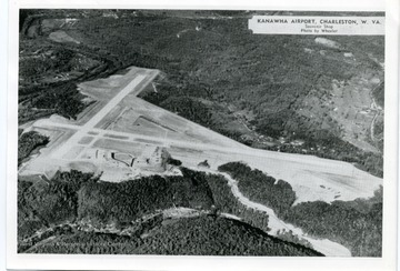
- Aerial View of Kanawha Airport, Charleston, W. Va.
- Date:
- 1952
- Description:
- 'Kanawha Airport, Charleston, W. Va., Elevation 985 feet, Class 4; Northeast-Southwest Runway 5200 feet. Northwest-Southeast Runway 4750 feet; More than 9,100,000 cubic yards rock and earth moved in its construction. Four and one half miles highway distance from downtown Charleston.'

- IDNO:
- 017617
- Title:
- Animal Husbandry Farm, West Virginia University
- Date:
- 1952

- IDNO:
- 017618
- Title:
- Aerial View of the West Virginia University Animal Husbandry Farm
- Date:
- 1952

- IDNO:
- 019750
- Title:
- Aerial View of Medical Center Site, West Virginia University
- Date:
- 1952


