Search Results
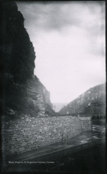
- IDNO:
- 028168
- Title:
- Near View of Rocks of Maryland Heights at Harper's Ferry, W. Va.
- Date:
- 1884/08/04
- Description:
- Gen. no. 144, neg. by D, No. 85. Plate maker I.C., Date 1884, August 4. Monday 5:30 P.M. Cloudy.

- IDNO:
- 028260
- Title:
- Town of Harpers Ferry and Jefferson Rock Looking North from Bank of Shenandoah River
- Date:
- 1884/08/04
- Description:
- '142(83)D; August 4, 1884, 4 pm, Monday (sun)'

- IDNO:
- 028383
- Title:
- Halltown a Few Miles Southwest from Harpers Ferry, W. Va.
- Date:
- 1884/08/02
- Description:
- '122(73)D. I.C.; Aug. 2, 1884, Saturday 10 a.m. cloudy; Halltown a few miles S.W. from Harpers Ferry. Looking N.E. toward Harpers Ferry. The town of Loudon Heights can be just made out. Halltown is only a cluster of a few houses, a RR station, factory and a store. In the village we passed a pretty pond which would have made a good picture, but we hurried through on account of the proximity of the R.R. The building with the cupola is a school house.'

- IDNO:
- 028384
- Title:
- Looking N.E. towards Harpers Ferry, W. Va.
- Date:
- 1884/08/01
- Description:
- '121 D.(72) I.C. 121; Aug. 1, 1884, Friday 6-20 p.m.; Half mile out of Charles Town. Looking N.E. towards Harpers Ferry. Maryland Heights are on the left of the gap and Loudoun Heights on the right. Through the gap on the N. side can be seen the South Mt. The nearer ridge under Maryland Heights is Bolivar Heights and the still nearer ridge extending across the whole picture is Halltown Heights and was the fortified line chosen by Sheridan when he took command in '64. On the extreme right lie the farms through which we wandered in lanes and field in search of hay, finally camping 1/2 mile or more away from the pike.'
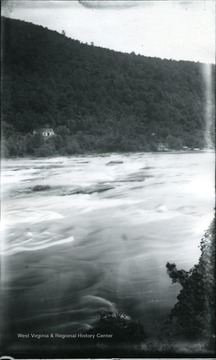
- IDNO:
- 028387
- Title:
- Rapids of Shenandoah River at Harpers Ferry, W. Va.
- Date:
- 1884/08/04
- Description:
- '143; 84D; August 4, 1884, Monday 4:20 pm.'

- IDNO:
- 029196
- Title:
- View from Loudoun Heights of Harpers Ferry and Bolivar Heights, W. Va.
- Date:
- 1901/11
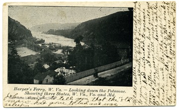
- IDNO:
- 029197
- Title:
- Looking Down the Potomac at Harper's Ferry, W. Va.
- Date:
- 1909/03/13
- Description:
- Showing Three States, W. Va., Va., and Md.
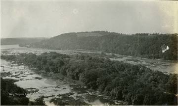
- IDNO:
- 037917
- Title:
- Potomac River at Harpers Ferry, W. Va.
- Description:
- A view looking up the Potomac River.
- IDNO:
- 037963
- Title:
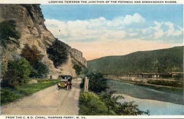
- Driving Along Chesapeake & Ohio Canal Near Harpers Ferry, W. Va.
- Description:
- Color postcard of a ca. 1918 touring car driving next to the the C&O Canal. The Harpers Ferry bridge crossing the confluence of the Potomac and the Shenandoah Rivers is in the background.
- IDNO:
- 039079
- Title:
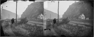
- Harpers Ferry Gap, Harpers Ferry, Va. (W. Va. )
- Date:
- 1862/10
- Description:
- Looking east along the Potomac River on the Virginia (West Virginia) side. The ruins of the Armory can be seen on the left and telegraph poles line the damaged tracks. Two men, one leaning on a telegraph pole and another next to the house are not identified. The photograph was taken several weeks after the September,1862 battle when Stonewall Jackson's artillery shelled the town, forcing the Union troops to surrender.
- IDNO:
- 039081
- Title:
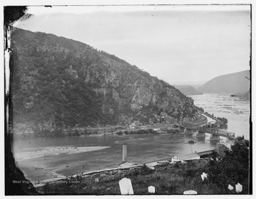
- Maryland Heights Across Potomac River at Harpers Ferry, Va, (W. Va.)
- Date:
- ca. 1862
- Description:
- Maryland, the Chesapeake & Ohio Canal and a reconstructed Baltimore and Ohio Railroad bridge on the Potomac River as viewed from the Harpers Ferry cemetery. Note the head stones in the foreground and the smoke stack of the burned out United States Armory below. The photograph was taken during the Civil War.
- IDNO:
- 039083
- Title:
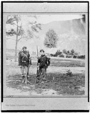
- Soldiers of 22nd New York Militia, Union Army, Harpers Ferry, Va. (W. Va.)
- Date:
- 1861
- Description:
- Two unidentified Union soldiers in uniform, full pack and armed on Camp Hill above Harpers Ferry during the Federal forces occupation of the area early in the Civil War. Note the huge bayonets attached to their rifles.


