Search Results
- IDNO:
- 042626
- Title:
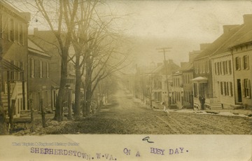
- Looking Down Street 'on a Busy Day', Shepherdstown, W. Va.
- Date:
- Undated
- Description:
- Dirt-paved main street looks desserted on this "busy day".(From postcard collection legacy system.)
- IDNO:
- 042627
- Title:
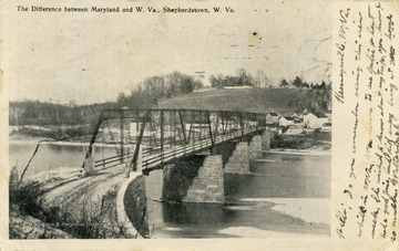
- Difference Between Maryland and W. Va.; Shepherdstown, W. Va.
- Date:
- ca. 1906
- Description:
- Bridge connecting the two states over the Potomac River. See the original for the correspondence.(From postcard collection legacy system.)
- IDNO:
- 042628
- Title:
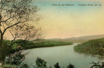
- View Up Potomac; Harpers Ferry, W. Va.
- Description:
- Published by The Albertype Company. (From postcard collection legacy system.)
- IDNO:
- 042629
- Title:
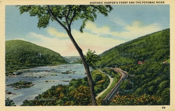
- Historic Harpers Ferry and Potomac River; Jefferson Co., W. Va.
- Description:
- Railroad tracks follow the Potomac River on the right side. See original for correspondence. Published by Marken and Bielfield Inc. (From postcard collection legacy system.)

- IDNO:
- 042630
- Title:
- Junction of Potomac and Shenandoah Rivers; Harpers Ferry, W. Va.
- Description:
- Meeting of the states of Maryland, West Virginia, and Virginia. Published by Walter E. Dittmeyer. (From postcard collection legacy system.)
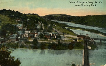
- IDNO:
- 042631
- Title:
- View From Chimney Rock of Harpers Ferry, W. Va.
- Description:
- Published by Louis Kaufmann & Sons. (From postcard collection legacy system.)
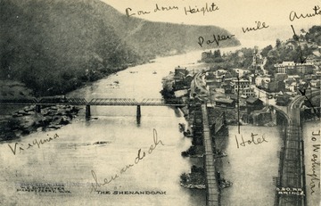
- IDNO:
- 042632
- Title:
- Harpers Ferry From Maryland Heights; Harpers Ferry, W. Va.
- Date:
- ca. 1906
- Description:
- From this view you can see such things as the Shenandoah River, Loudoun Heights, Virginia, a Baltimore and Ohio Railroad Bridge, as well as a paper mill and hotel in the town of Harpers Ferry.(From postcard collection legacy system.)
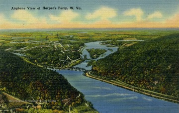
- IDNO:
- 042633
- Title:
- Airplane View of Harpers Ferry, W. Va.
- Description:
- Caption on back of postcard reads: "Harper's Ferry, West Virginia is the lowest point in the State having an elevation of 272 feet above sea level. This view shows the confluence of the Shenandoah and Potomac Rivers." Published by Nichols & Stuck. (From postcard collection legacy system.)
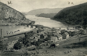
- IDNO:
- 042634
- Title:
- Harper's Ferry in By Gone Days, Harpers Ferry, W. Va.
- Date:
- ca. 1900
- Description:
- Small white X in the middle of postcard on building is John Brown's Fort. All three states, Virginia, Maryland, and West Virginia can be seen as well as the confluence of the Potomac and Shenandoah Rivers. Published by W.L. Erwin. (From postcard collection legacy system.)
- IDNO:
- 042635
- Title:
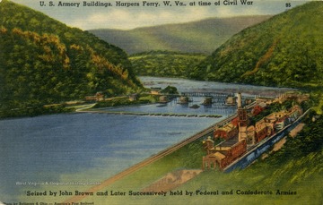
- U.S. Armory Buildings at Time of Civil War; Harpers Ferry, W. Va.
- Date:
- ca. 1947
- Description:
- Seized by John Brown and later 'successively' held by Federal and Confederate Armies. Caption on back of postcard reads: "Of the many places that were in a constant state of siege during the Civil War, Harper's Ferry suffered most heavily. The Government arsenal and armories located there were destroyed by Federal Troops to prevent their capture by the Confederates. These buildings were erected sometime after the Revolutionary War, and it was there that many of the old flint lock rifles were made that were used in the War of 1812." Published by John Myerly Company. (From postcard collection legacy system.)

- IDNO:
- 042636
- Title:
- The Gap at Harpers Ferry, W. Va.
- Date:
- ca. 1905
- Description:
- View from the Camp Hill area in Harpers Ferry includes the confluence of the Potomac and Shenandoah Rivers, Maryland Heights and "Virginia Heights" (Loudoun Heights). (From postcard collection legacy system.)
- IDNO:
- 042637
- Title:
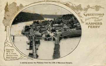
- Looking Across Potomac From Cliffs of Maryland Heights; Harper's Ferry, W. Va.
- Description:
- At the confluence of the Potomac and Shenandoah Rivers where three bridges connect West Virginia, Virginia and Maryland. From postcard collection legacy system.)


