Search Results

- IDNO:
- 053754
- Title:
- The Trough, South Branch Potomac River, W. Va.
- Date:
- undated
- Description:
- Text on the back reads, "Here the South Branch of the Potomac flows through the Trough. It can best be seen only by boat and is about 2 miles long, just off U. S. 220 in Hardy and Hampshire County, W. Va."

- IDNO:
- 053755
- Title:
- North Fork of South Branch Potomac River, Seen From Wildcat Hill, W. Va.
- Date:
- undated
- IDNO:
- 053771
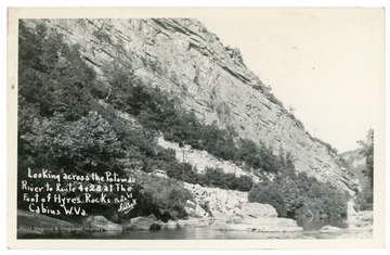
- Title:
- Hyres Rocks, Cabins, W. Va.
- Date:
- ca. 1949
- Description:
- Text reads, "Looking across the Potomac River to Routes 4 and 28 at the foot of Hyres Rocks, Cabins, W. Va."
- IDNO:
- 053782
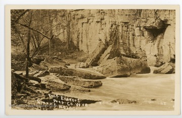
- Title:
- Rock Brokers, Smoke Holes, Pendleton Co., W. Va.
- Date:
- undated
- Description:
- "Smoke Holes" refers to the Smoke Hole Canyon, a 20 mile gorge carved by the South Branch Potomac River in the Spruce Knob-Seneca Rocks National Recreation Area.

- IDNO:
- 053783
- Title:
- Deer Rock and Breakers near Hermit Island, Smoke Holes, W. Va.
- Date:
- undated
- Description:
- "Smoke Holes" refers to Smoke Hole Canyon, a gorge carved by the South Branch Potomac River in the Spruce Knob-Seneca Rocks National Recreation Area.

- IDNO:
- 053785
- Title:
- Eagle Rock in the Smoke Holes, Pendleton Co., W. Va.
- Date:
- undated
- Description:
- "Smoke Holes" refers to the Smoke Hole Canyon, a 20 mile gorge carved by the South Branch Potomac River in Spruce Knob-Seneca Rocks National Recreation Area.

- IDNO:
- 053786
- Title:
- Eagle Rock in the Smoke Holes, Pendleton Co., W. Va.
- Date:
- undated
- Description:
- "Smoke Holes" refers to the Smoke Hole Canyon, a 20 mile gorge carved by the South Branch Potomac River in the Spruce Knob-Seneca Rocks National Recreation Area.