Search Results
- IDNO:
- 030855
- Title:
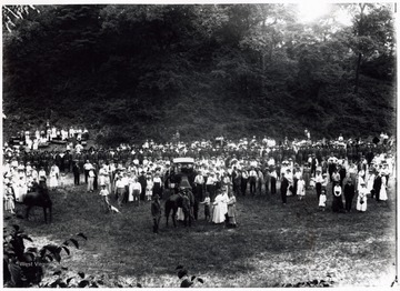
- Crowd Watching Demonstration by Troops
- Date:
- 1917
- Description:
- A photograph of a crowd gathered in a field to watch a demonstration by troops.
- IDNO:
- 030856
- Title:
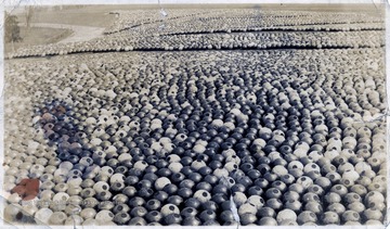
- Cannon Shells at Penniman, Virginia
- Date:
- 1918
- Description:
- A large collection of bomb shells in a field.
- IDNO:
- 030857
- Title:
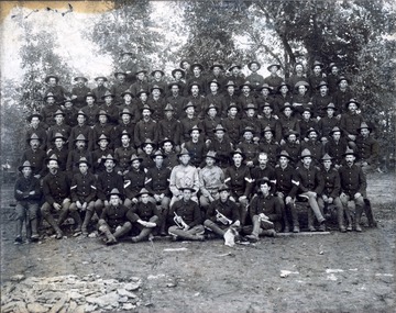
- Military Group
- Date:
- ca. 1898
- Description:
- Likely the First West Virginia Volunteer Infantry
- IDNO:
- 030858
- Title:
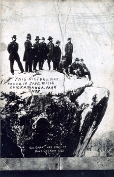
- General Grant and Staff on Point Lookout
- Date:
- 1863
- Description:
- This picture was found in Jays Mills Chickamauga Park 1898.
- IDNO:
- 030859
- Title:
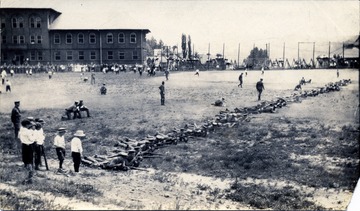
- Cadets Undergo Weapons Training, West Virginia University
- Date:
- ca. 1918
- Description:
- A photograph of a military unit engaged in training exercises with onlookers along the perimeter.

- IDNO:
- 030860
- Title:
- Kanawha County Historic Marker on U. S. Route 119 in West Virginia
- Date:
- 1951
- Description:
- "Kanawha County--Authorized, 1788 and organized, 1789, from Montgomery and Greenbrier. Named for Kanawha River bearing name of Indian tribe. Salt making brought early settlers into this valley and from it grew vast modern chemical plants."

- IDNO:
- 030861
- Title:
- Clay County Historic Marker on U. S. Route 119 in West Virginia
- Date:
- 1951
- Description:
- "Clay County--formed in 1858 from Braxton and Nicholas. Named for the great Kentuckian, Henry Clay, who was so popular in western Virginia that in 1820 a monument was erected to him for his part in bringing the National Road to Wheeling. A man on left is George Eddy."

- IDNO:
- 030862
- Title:
- Logan County Historic Marker On U. S. Route 119 in West Virginia
- Date:
- 1951
- Description:
- "Formed in 1824 from Cabell, Kanawha, Giles and Tazewell. Named for Logan, the famous chief of the Mingo Indians, whose "Lament" is most noted example of Indian eloquence. Logan County ranks second in State coal production."
- IDNO:
- 030863
- Title:
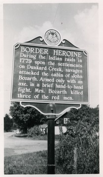
- Border Heroine Historic Marker on State Route 7 near Blacksville, W. Va.
- Date:
- 1951
- Description:
- "During the Indian raids in 1779 upon the settlements on Dunkard Creek, savages attacked the cabin of John Bozarth. Armed only with an axe, in a brief hand-to-hand flight, Mrs. Bozarth killed three of the red men."

- IDNO:
- 030864
- Title:
- Valley Falls Historic Marker on U. S. Route 50 near Grafton, W. Va.
- Date:
- 1951
- Description:
- "Beauty spot six miles north on the boundary of Taylor and Marion counties where Tygarts Valley River dashes through a mile-long gorge in series of lovely falls and rapids. Included in 1000-acre grant to Thomas Parkeson in 1773."
- IDNO:
- 030865
- Title:
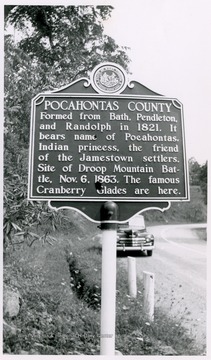
- Pocahontas County Historic Marker in West Virginia
- Date:
- 1952
- Description:
- "Formed from Bath. Pendleton, and Randolph in 1821. It bears name of Pocahontas, Indian princess, the friend of the Jamestown settlers. Site of Droop Mountain Battle, Nov. 6, 1863. The famous Cranberry Glades are here."

- IDNO:
- 030866
- Title:
- Edray Historic Marker on U. S. Route 219 in Pocahontas County, W. Va.
- Date:
- 1952
- Description:
- "Site of early settlement and fort of Thomas Drinnon. Scene of attacks by Indians in 1774 and 1778. To the east, on the land of Jacob Warwick, stood Fort Clover Lick, garrisoned during the Revolutionary War by Augusta County militia."