Search Results

- IDNO:
- 028383
- Title:
- Halltown a Few Miles Southwest from Harpers Ferry, W. Va.
- Date:
- 1884/08/02
- Description:
- '122(73)D. I.C.; Aug. 2, 1884, Saturday 10 a.m. cloudy; Halltown a few miles S.W. from Harpers Ferry. Looking N.E. toward Harpers Ferry. The town of Loudon Heights can be just made out. Halltown is only a cluster of a few houses, a RR station, factory and a store. In the village we passed a pretty pond which would have made a good picture, but we hurried through on account of the proximity of the R.R. The building with the cupola is a school house.'

- IDNO:
- 028384
- Title:
- Looking N.E. towards Harpers Ferry, W. Va.
- Date:
- 1884/08/01
- Description:
- '121 D.(72) I.C. 121; Aug. 1, 1884, Friday 6-20 p.m.; Half mile out of Charles Town. Looking N.E. towards Harpers Ferry. Maryland Heights are on the left of the gap and Loudoun Heights on the right. Through the gap on the N. side can be seen the South Mt. The nearer ridge under Maryland Heights is Bolivar Heights and the still nearer ridge extending across the whole picture is Halltown Heights and was the fortified line chosen by Sheridan when he took command in '64. On the extreme right lie the farms through which we wandered in lanes and field in search of hay, finally camping 1/2 mile or more away from the pike.'
- IDNO:
- 028385
- Title:
- Charles Town, Old Virginia, From Pike 3/4 of a Mile South of Town
- Date:
- 1884/08/01
- Description:
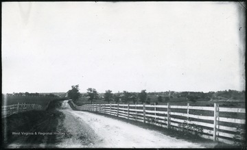
- '(71)D.119; August 1, 1884, Friday 5-20 pm. clear sun; Bonfire burning on right. Court house with clock tower in center.'
- IDNO:
- 028386
- Title:
- Berryville From the West
- Date:
- 1884/08/01
- Description:
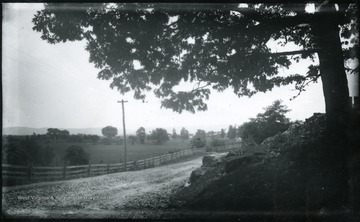
- '116.D.(70); August 1, 1884, Friday 10-25 am; bright sun; Camera stands at the entrance to the grounds of a fine old house on the right hand. Boy on horseback just behind the camera wanted to be taken, sorry I didn't. View is looking East at Berryville. The Pike turns at right angle toward the left to Harpers Ferry.'
- IDNO:
- 028387
- Title:
- Rapids of Shenandoah River at Harpers Ferry, W. Va.
- Date:
- 1884/08/04
- Description:
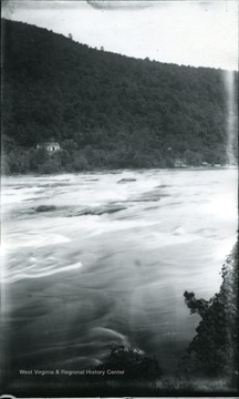
- '143; 84D; August 4, 1884, Monday 4:20 pm.'

- IDNO:
- 028388
- Title:
- Two Boys Who Made Friends With Walter Biscoe
- Date:
- 1884/08/02
- Description:
- A photograph of two young boys on the left with a river below. '137.W.(58); August 2, 1884, Saturday 6 pm.'

- IDNO:
- 028389
- Title:
- On Shaffer's Mountain, Allegheny in the Distance
- Date:
- 1884/07/16
- Description:
- '51.W.23; Wed., July 16 after 6 P.M.' A landscape of a mountain range and a country road, with a carriage in the distance.
- IDNO:
- 028390
- Title:
- Threshing Wheat near Troy, Gilmer County, W. Va.
- Date:
- 1884/07/09
- Description:
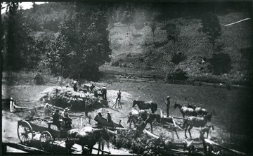
- A picture of farm workers in a field. 'Team of 10 men, 6 horses, and colt. 1/2 mile out of Troy, Gilmer County.; No. 27 D(15); July 9, Wed. 11:05 am, clear'
- IDNO:
- 028391
- Title:
- Cedar Creek Battlefield, View of Slope Occupied by Crooks Camp
- Date:
- 1884/07/30
- Description:
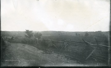
- '93 D(58); July 30, 1884, Wednesday 8:45 am. About a mile down the valley from Cupp's Hill; Looking about East...Shows the series of low hills occupied by the camps of Crook's army corp which is on the other or Eastern side of Cedar Creek, up behind which the Confederate columns marched in their surprise of the Union.'
- IDNO:
- 028392
- Title:
- Stone House Near Tumbling Run
- Date:
- 1884/07/29
- Description:
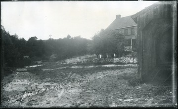
- 'The entire house is only a few yards from the great bridge and is on the right of the pike as one comes from Strasburg, up the valley. The road on the left becomes Tumbling Run and then crosses the opposite bank.; 90.D(56); July 29, 1884, Tuesday 2:15 pm'
- IDNO:
- 028393
- Title:
- Battlefield of Fisher Hill from Wharton's Position (Confederate) Commanding Pike
- Date:
- 1884/07/28
- Description:
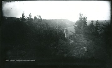
- '89.D.(55); July 28, 1884 Monday 5:35 pm; Dark, misting; On extreme right is mill(?) at edge of Strasburg. The field of corn is on the flat land of the river a little way to the right. The valley pike was commanded for a mile by the Confed. battery of Wharton stationed right where the camera stands. Sheridan's army turned off the pike onto the higher land west; (left in the view). The valley of Tumbling Run is hidden by the trees of the foreground, likewise the stone house by the bridge.'
- IDNO:
- 028394
- Title:
- Fisher Hill Battlefield Looking Up Valley of Tumbling Run, Westerly
- Date:
- 1884/07/28
- Description:
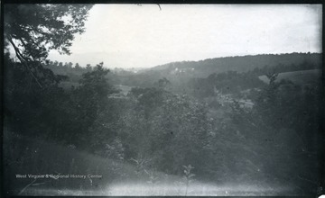
- '88.D.(54); July 28, 1884, Monday 5.30 pm; Misty and very dark; The right of the picture is ground occupied by Sheridan. The left by Confed. army. The R.R. embankment can be detected running left to right just in front of the houses. The Mts. in the distance are those along which the flank movement of Gen. Crook was made, by which about 4 p.m. he came upon the left rear of the Confed. over beyond the R.R. On the left in mid-distance is the field occupied by Gordon which No's 85, 86 were taken.'


