Search Results

- IDNO:
- 000049
- Title:
- Shay No. 4 Mower Lumber Company, Cass, W. Va.
- Date:
- 1945/11/10
- Description:
- Crane loading logs on flatbed train car. Workers securing logs.

- IDNO:
- 000050
- Title:
- Cass Mill Log Pond, Mower Lumber Co.
- Date:
- 1946/05/20
- Description:
- Cass, W. Va.; Logs floating in water and loaded on train; D.D. Brown Collection
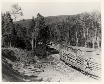
- IDNO:
- 000051
- Title:
- Log Train Passing Wooden Buildings
- Date:
- 1946/08/07
- Description:
- Cass, W. Va.; D.D. Brown Collection

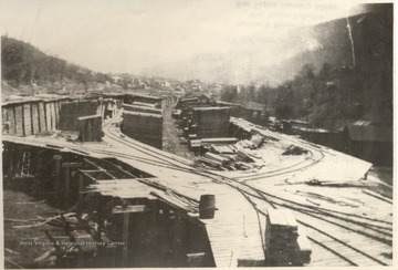
- IDNO:
- 000052
- Title:
- Log Train at the Calfisch Lumber Co., Hambleton, Tucker County, W. Va.
- Date:
- ca. 1907
- Description:
- O. Homer Floyd Fansler; Hendricks, W.V.
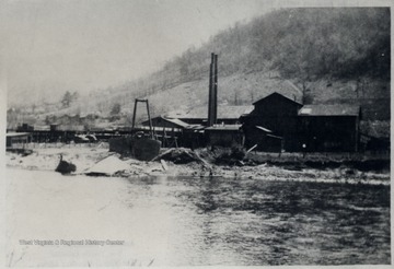
- IDNO:
- 000053
- Title:
- Calfisch Lumber Company Yard at Hambleton, Tucker County, W. Va.
- Date:
- ca. 1907
- Description:
- O. Homer Floyd Fansler; Hendricks, W.V.
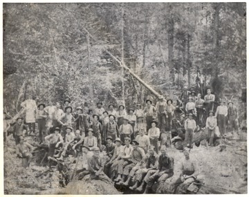
- IDNO:
- 000054
- Title:
- Calfisch Sawmill at Hambleton, Tucker County, W. Va.
- Date:
- ca. 1907
- Description:
- O. Homer Floyd Fansler, Hendricks, W.V.
- IDNO:
- 000055
- Title:
- Logging Crew
- Date:
- undated
- Description:
- Group Portrait of Large Lumbering Crew in Woods.
- IDNO:
- 000056
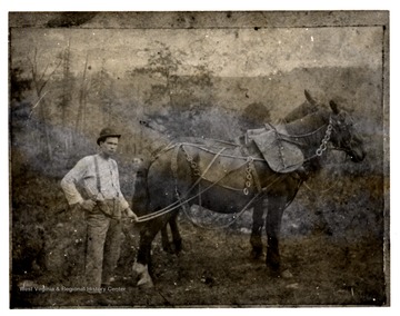
- Title:
- Logging Teamster With His Horses
- Date:
- ca 1900
- IDNO:
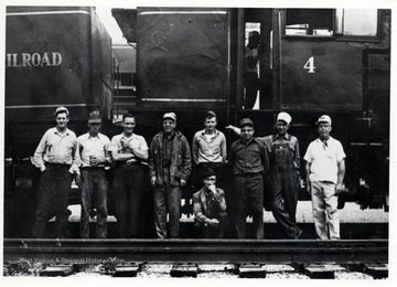
- 000057
- Title:
- Shay No. 4 and Crew
- Date:
- undated
- Description:
- L. to R.: Leonard Long, Charles Queen, Kenneth Caplinger, Walter "Pop" Good, Robert Cassell, Percy F. "Bus" Long (Wheeling), Ivan Clarkson, Clyde Galford, Kyle "Catty" Neighbors; Cass, W. Va.
- IDNO:
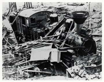
- 000058
- Title:
- Shay No. 6. End of No. 6
- Date:
- 1968/03
- Description:
- Collapsed building on top of train. Premar Coal Co. Property, Austin, W. Va.; Lima CN/#1907 of 1907; Scrapped Summer of 1969; EX-GL and E#6.

- IDNO:
- 000059
- Title:
- Shay No. 12 Between Coal Hauling on W.M. 193
- Date:
- undated
- Description:
- Train at Cass Yard, Cass, WV; Ivan Clarkson Collection.

- IDNO:
- 000060
- Title:
- First Regular Revenue Train to Bald Knob
- Date:
- 1968/05/26 (Sunday)
- Description:
- Bald Knob Trains: 2nd Car Brakeman, Robert Long; Conductor, Gearold Cassoll;
Standing on rear platform: Ken Caplinger; Cab of No. 7, Artie Barkley; On ground, right foreground, "Doc" Carlson; photograph from John P. Killorah, Promotion Officer, WV State Parks, Chas, WV 25305.


